Ecommerce Fulfillment Guide
When it comes to ecommerce fulfillment, there are a lot

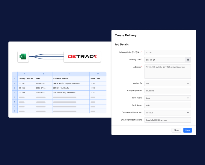
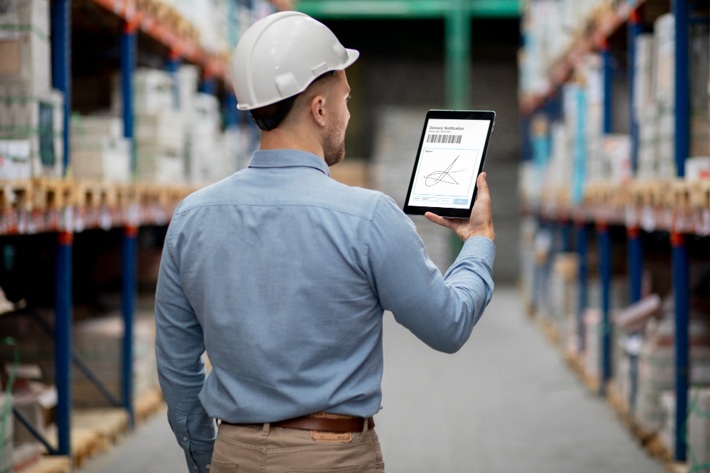
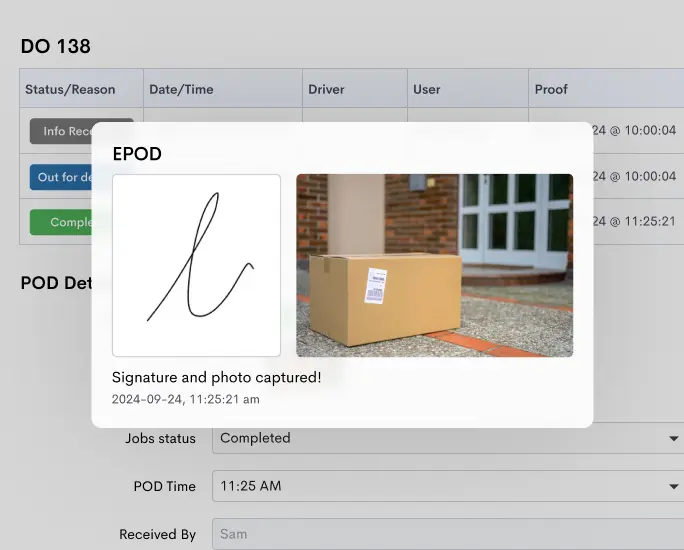
Eliminate the hassle of paper forms and reduce delivery disputes with e-PODs that are stored securely in the cloud. Delivery proof can be easily captured via the Detrack driver app.
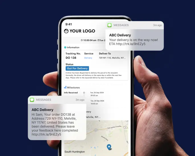
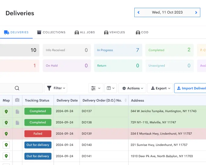
Learn More ›Get real-time delivery updates for better control of your fleet. Customers can also track their delivery progress in real time with a map-based tracking page.
Learn More ›Keep customers informed with timely updates. Enhance your customer experience while reducing missed deliveries.
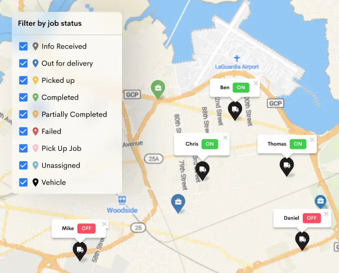
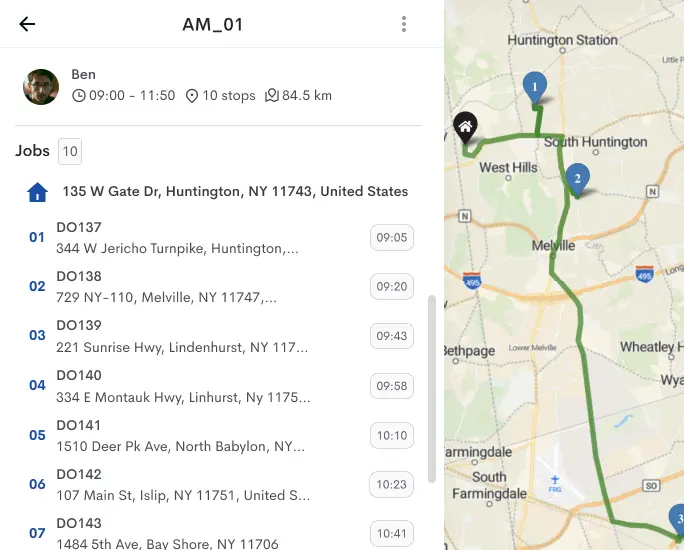
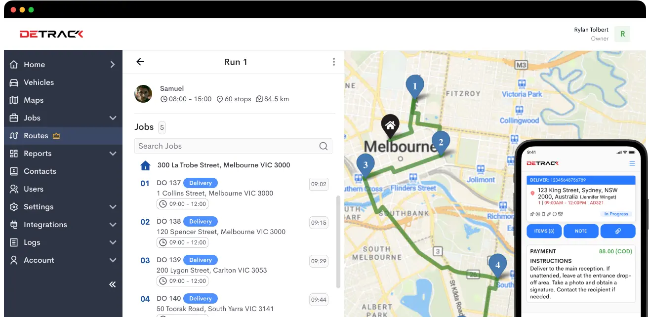
Learn More ›Streamline fleet operations with live vehicle tracking & efficient job assignment. Automate recurring jobs and save time on manual entry.
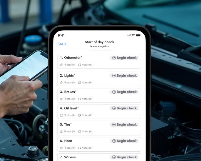
Learn More ›Keep your fleet safe & compliant with regular vehicle checks, done seamlessly through the driver app.
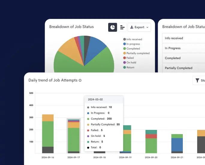
Learn More ›Gain valuable insights on your delivery performance and make better operational decisions.
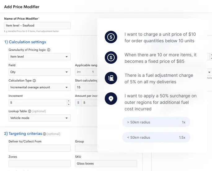
Learn More ›Configure your pricing based on rules such as such as weight, quantity, item type, location and more.
Learn More ›