Geocoding is a “guessing” algorithm, which can fail or produce inaccurate results. To correct the issue, you may manually locate your address for your delivery / collection job.
Steps
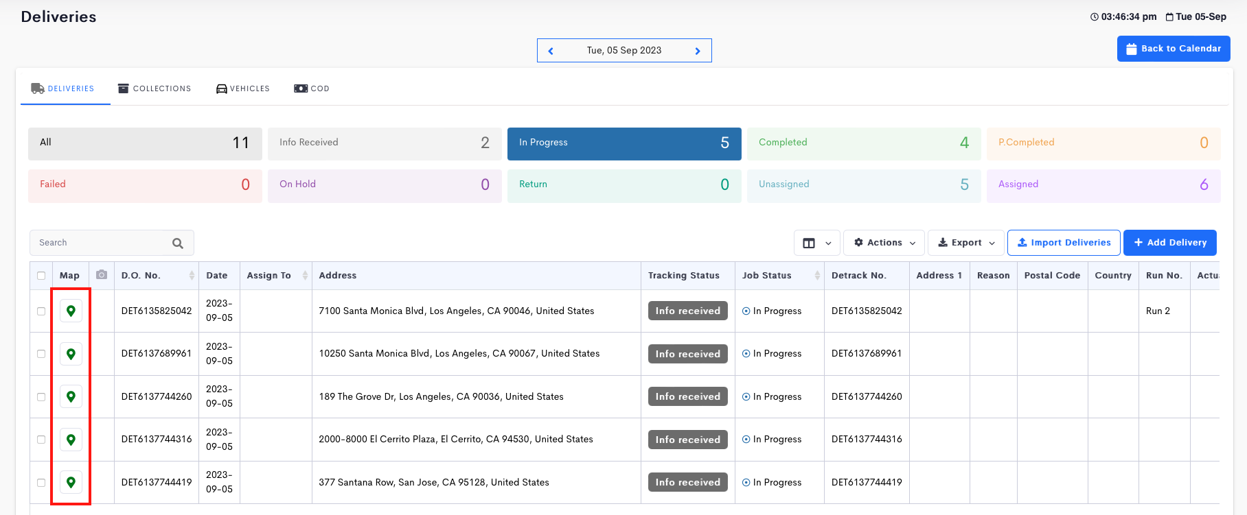
- Click the map-marker icon under the Map column to open a pop-up.

- On the map, you may drag-and-drop the map marker pin to locate your address.

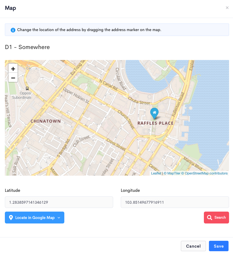
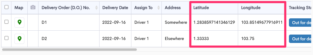
- Click Save when done. The located address will appear under the Address Latitude and Address Longitude columns.

Checking Of Address Against Google Map
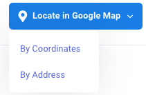
- To check you input address on Google Map, click on the Locate in Google Map button.

- A drop-down will appear.

- Clicking the By Address option will open up a new window and send your input address to Google Map to search.
 There are 2 ways to obtain the latitude and longitude.
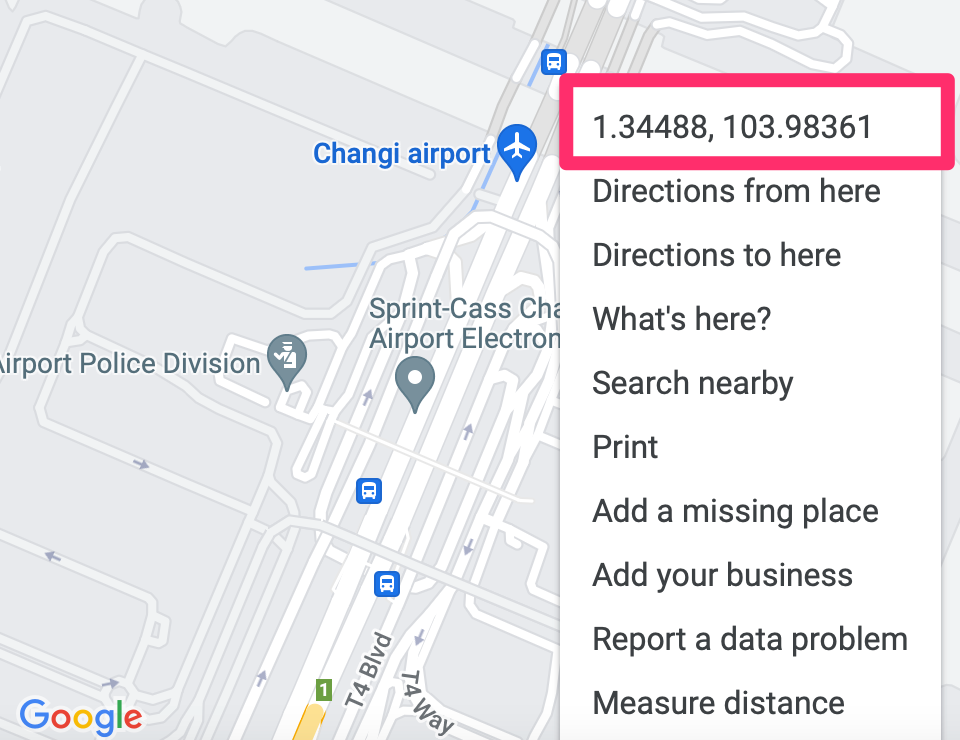
- Right-click on the map-marker in Google map, and copy the latitude and longitude.

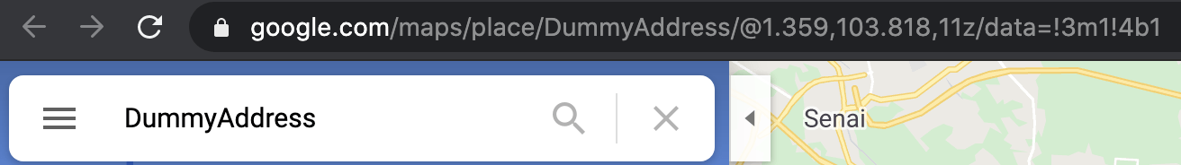
- From the URL of the address bar to correct your latitude and longitude in Detrack.
e.g. https://www.google.com/maps/@1.3463895,103.9791334,16.2z?hl=en
- Right-click on the map-marker in Google map, and copy the latitude and longitude.
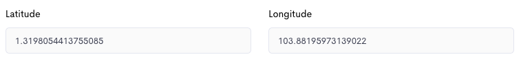
- Paste the latitude and longitude back into job.

- Click Save when done.
 There are 2 ways to obtain the latitude and longitude.